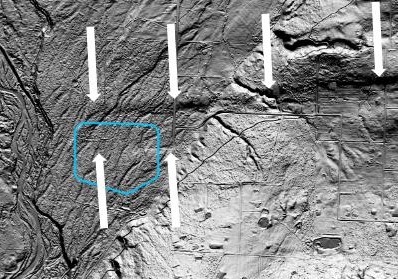
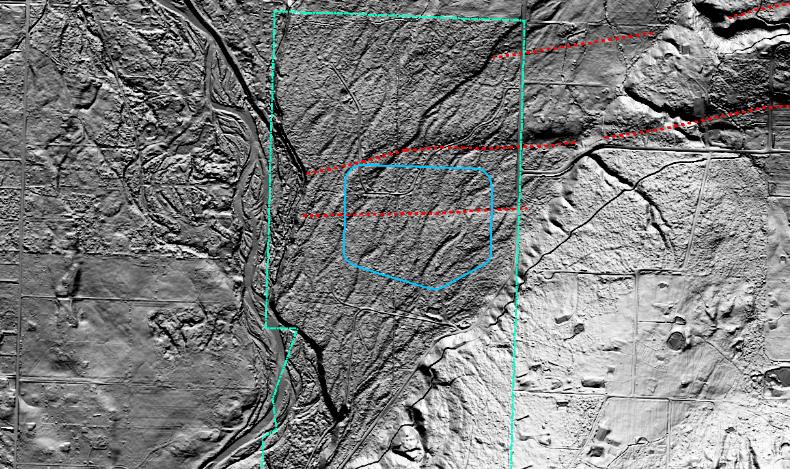
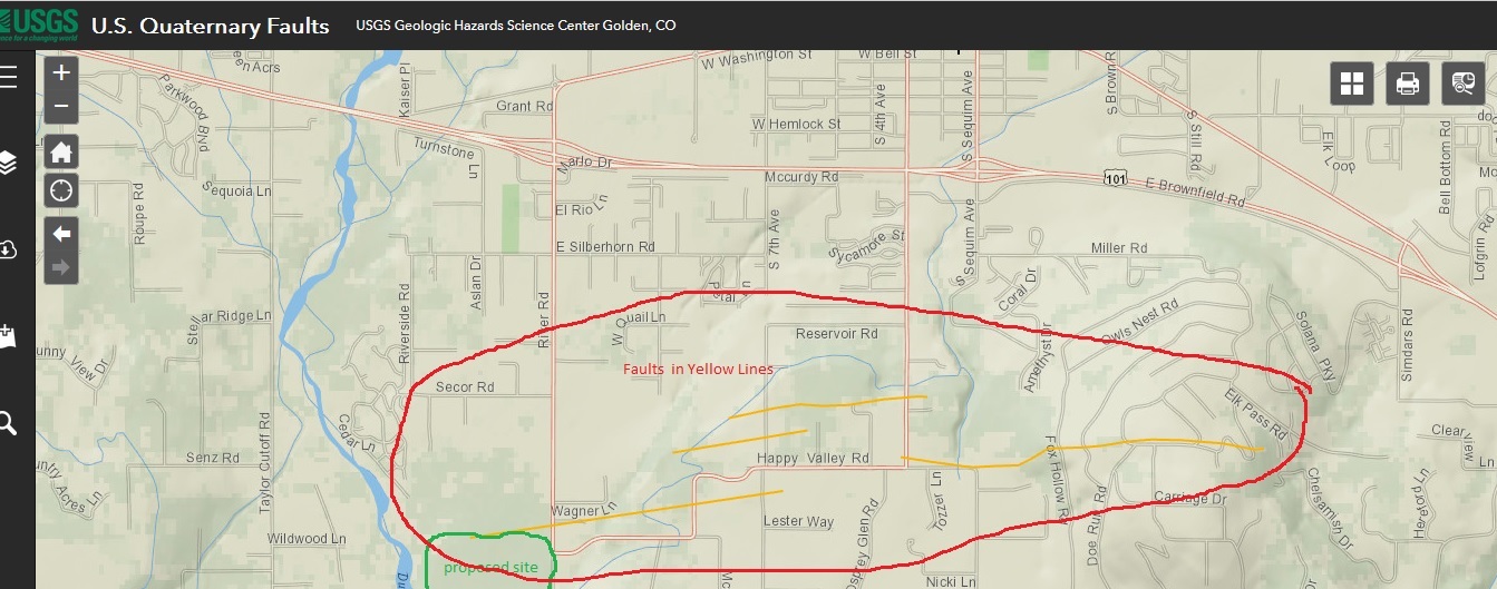
Earthquake Fault Lines were discovered years ago along Happy Valley Road adjacent to the proposed 526,000,000 gallon above-ground reservoir. These Fault Lines have been confirmed.
Read Draft Report here. https://riverroadreservoir.com/document/fault-hazard-evaluation-report-dungeness-off-channel-reservoir/
If you have any questions, please call 360.200-5571 and we will return your call or email to info@riverroadreservoir.com.
————————————
The United States Geological Services identified probable earthquake faults near the proposed site for the Off Channel Reservoir many years ago. Through the initial design process, the county has dismissed the fault lines based on a casual walk through at the site. However, review of state of the art aerial imagery called LIDAR, probable earthquake fault lines have been discovered to run through the center of the proposed reservoir and through the over 30 foot high earthen dam holding the water above the ground. The idea that a half billion gallons of water can be safe in a earthquake is impossible to grasp. See the document library for original source documents.
It is worth noting that the County is studying ways to mitigate the impact of these fault lines. See documents below. One wonders if they will study how best to insure the homes in the downstream neighborhoods. And who will be liable if a breach kills hundreds of neighbors.
Shannon and Wilson on Sequim Earthquake Faults/
E-mail correspondence regarding seismic reconnaissance between county and engineers/
The first two images are from an engineering firm contracted by the County to review current LIDAR data for earthquake faults. LIDAR is an advanced optical “radar” that penetrates vegetation, etc. that shows the underlying earth surface. In the first image the proposed reservoir is outlined in blue and the fault lines follow the arrows. In the second image the entire parcel is outlined in green, the proposed reservoir in blue, and the fault lines in red. The third image is published by USGS and is based on earlier research. The proposed reservoir is outlined in green and the fault lines in yellow. The first two images present the most current information known (2023). The third image is derived from a much earlier USGS map. Please review the source documents linked above.
Please review the open letter regarding the Happy Valley Faults. https://riverroadreservoir.com/wp-content/uploads/2023/01/faults_reservoir-1.pdf (Note this section was written in 2022.)
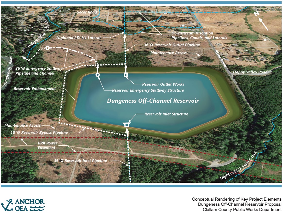
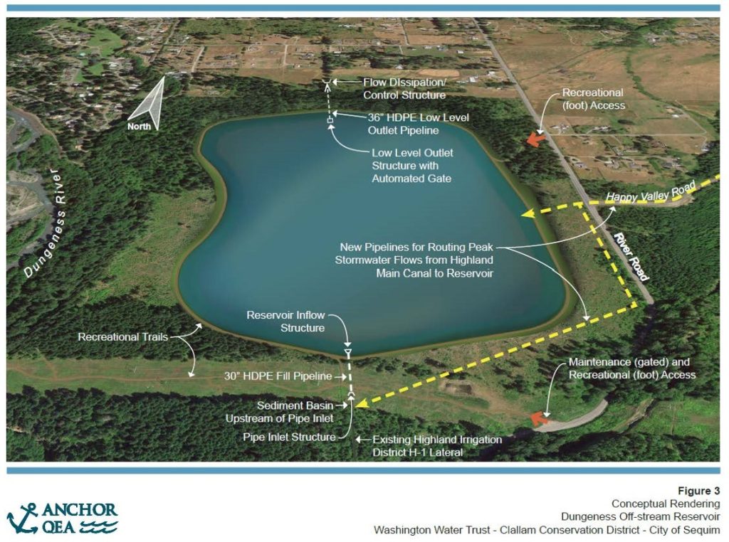
The two drawings below are the rendering of the original concept (bottom drawing), and the current proposed design (top drawing). The primary difference is that the current design calls for a three story high dam surrounding all the water just off Happy Valley Road with most of the water above ground level, but approximately a third of it below ground. The original design called for a larger area under water designed somewhat like a “kiddie pool” made from rocky soil and more or less perched on the ground surface. The narrative about the original concept suggested the reservoir would serve some recreational needs. The community thought there would be a reasonable ten foot high embankment, along with access for fishing and paddling. As currently proposed, there will be no public access to this 526 million gallons of water surrounded with a 30 foot high “dirt dam” and secured by chain link fences. And it is worth noting that current recreational uses of the site will be severely impacted as many of the trails will be under water.
The bottom line is that they are planning a three story high dam made from rocky soil near the Sequim Earthquake Faults surrounded by a chain link fence with over 500 million gallons of water, most of which will be above ground and above our heads. The plans need to be changed to put that water safely below ground level. And the neighbors were never asked about their concerns. The project was proposed by people who don’t live downstream from the site and designed by engineers a hundred miles away.
The technical documents listed below are indeed technical, but don’t let that put you off. It gets easier every time you read them.
[Edit] Note the original “final” proposal in 2016 has been found and it also seems to place the bulk of 500 million gallons of water above ground, though community members thought it was intended to be a much lower dam. We have not seen the full plans from the original proposal that was submitted to the Department of Ecology, but you can see the summary of the proposal here. Original-Dungeness-Off-stream-Reservoir-Project-Proposal-FINAL-2016.pdf
See the current plans here: Dungeness-Off-Channel-Reservoir_30PCT-Plans_17X11_20220314.pdf
See the background documents for the current plans (large document): Dungeness-Reservoir_Preliminary-BODR_FINAL_03142022-1.pdf
See the proposed solution to make it safe: A safe solution for the reservoir
